Path Of The Gods Hiking Guide: Distance, Difficulty And How To Get There
The trail has a grand name and a very ordinary beginning: a bus stop in a mountain village 630 metres above a coastline most visitors only ever see from the water. From there it runs west along the ridge and finishes in a hamlet stacked above Positano. This guide covers the real distance, the real difficulty, the buses at both ends, and the parts that catch people out.
Walk independently with the route and transport plan below, or compare a guided mountain outing for interpretation and route support. The featured 4.5-hour hike starts in Bomerano and ends in Nocelle; transfers are not included. Choose Your Experience Below.
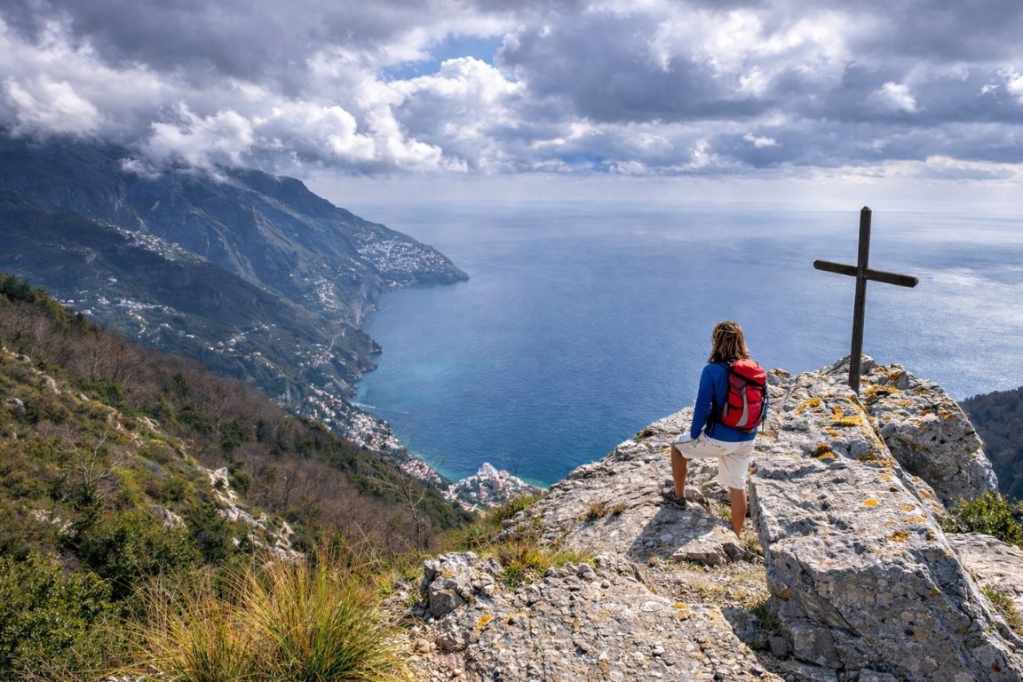
Ask five sources how long this walk is and you will get five answers, ranging from 5.3 km to nearly 8. Ask how hard it is and you will hear everything from "an easy stroll" to "not suitable for children or anyone with vertigo". Both camps are quoting real sources. The gap between them is the reason so many people arrive at the trailhead in the wrong shoes, at the wrong hour, in the wrong month. What follows is the walk described from the figures that are actually published, with the disagreements laid out rather than averaged away.
The same walk, five published distances
Every figure above is a real published measurement of the Bomerano to Nocelle route, not an estimate. They disagree because some sources measure only the signed trail, some add the walk in from the bus stop, some continue down towards Positano, and GPS tracks pick up extra length on switchbacks. The 5.3 km figure is the official one from CAI Monti Lattari, the club that maintains and signs path 327.
Both the independent crossing and featured guided hikefeatured guided hike run from Bomerano to Nocelle. Add travel to Bomerano and onward travel from Nocelle; a guide does not remove exposed terrain or the operator’s participation restrictions.
The Quick Answer
Walk it east to west, from Piazza Paolo Capasso in Bomerano to Nocelle, and you go with the drop rather than against it, with the view ahead of you the whole way. The Italian Alpine Club section that maintains and signs the route along the ridge measures it at 5.3 km, with 184 metres of climbing and 356 metres of descent, and allows two hours in each direction. Start early, carry two litres of water, and treat the steps at the end as a separate event.
What Exactly Is The Sentiero Degli Dei?
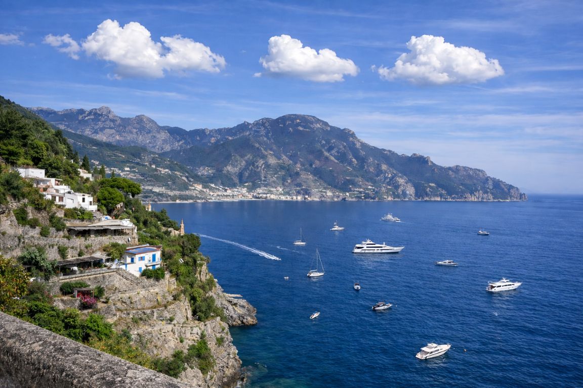
It is a signed mountain path along the seaward ridge of the Lattari range, running from Bomerano, a hamlet of the comune of Agerola, west to Nocelle, a hamlet of Positano. In the Italian Alpine Club's numbering it is path 327, graded E, with a high point of 630 metres and a low point of 437 metres at Nocelle. The English name, Path of the Gods, is a translation of the Italian, and nobody has ever needed to justify it standing on the traverse below the Grotta del Biscotto.
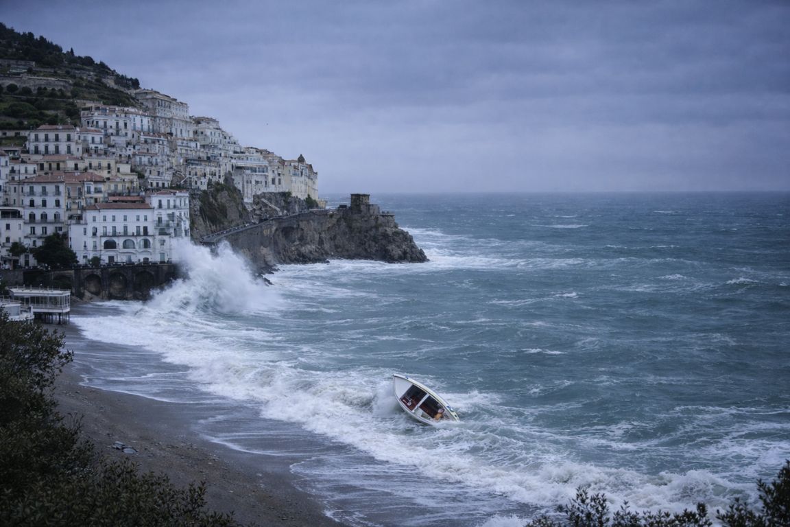
The route is not a modern tourist creation. It is one thread in the old network of mule tracks and terrace paths that linked the mountain villages of Agerola with the fishing settlements below, back when the coast road did not exist and the sea was the motorway. Sections are cut into rock, sections run between dry-stone walls and vine terraces, and one long stretch passes under an overhang where the ruins of cave dwellings are still visible, hollowed out with holes for doors and windows.
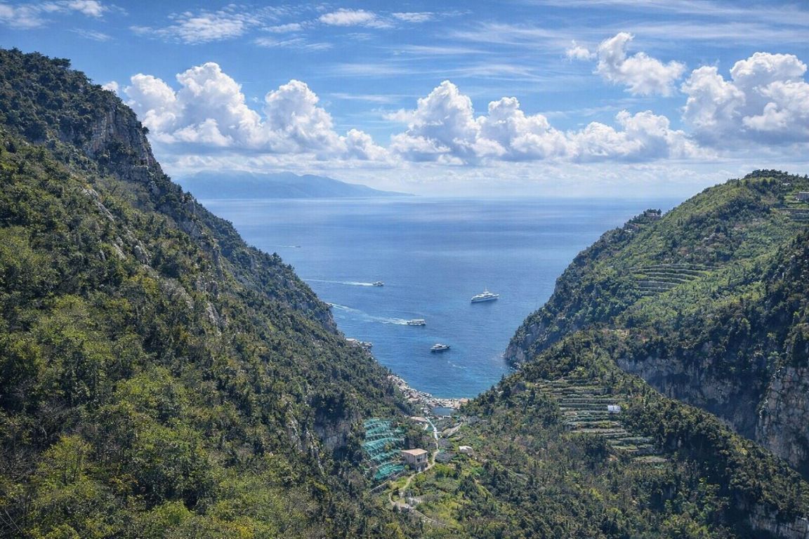
The two ends could not be more different in character. Agerola sits on a high shelf behind the coast, green, agricultural and cool, known for its dairy and its bread rather than its beaches. Nocelle hangs above Positano at around 420 to 437 metres, reachable only by a small road and a very long staircase until relatively recently. Walking between them in a morning is the closest thing the region has to time travel.
The waymarking is the standard Italian red-and-white flash. On the ground you will see both the number 327 and, on older signs, the number 02, which is the local Monti Lattari numbering the trail carried before. Both mean the same path. The official trail sheet from CAI Monti Lattari is the single most reliable set of numbers published anywhere for this route.
How Long Is The Path Of The Gods, And Why Does Every Source Give A Different Number?
The signed Bomerano to Nocelle route is 5.3 km according to the club that maintains it. Other reputable sources publish 5.6 km, 6.1 km and 7.8 km for what they also call Bomerano to Nocelle. None of them is lying. They are measuring slightly different things, and knowing which is which stops you from budgeting the wrong amount of time.
| Source | Distance published | Elevation | Time allowed |
|---|---|---|---|
| CAI Monti Lattari, official trail sheet for path 327 | 5.3 km | 184 m up, 356 m down | 2 hours each way |
| Earth Trekkers, from a recorded GPS track | 5.6 km | 215 m up, 410 m down | 1.5 to 3 hours |
| AllTrails listing for Bomerano to Nocelle | 6.1 km (3.8 miles) | 734 ft of gain (about 224 m) | not stated |
| positano.com | 7.8 km | not stated | about 3 hours |
| Comune di Agerola, official page | no total given | Colle la Serra 580 m, Nocelle 420 m | not stated |
Three things explain most of the spread. Some measurements start at the trail sign and some start at the bus stop in Bomerano, which adds several hundred metres of village lane. Some stop at the first houses of Nocelle and some continue through the hamlet or down towards the coast road. And a GPS track recorded on a phone always reads longer than a surveyed line, because every switchback and every step-around adds a few metres that a map measurement smooths out.
The practical takeaway: plan around three hours of walking, not two. The official two-hour figure assumes steady movement by people who walk in mountains for fun. Everybody else stops for photographs roughly every four minutes for the first hour, and the view genuinely does earn it.
What does the guided Bomerano-to-Nocelle route involve? Walk the Path of the Gods with an English-speaking guide and walking sticks on a 4.5-hour outing. Discover The Guided Path Of The Gods Hike
How Hard Is The Path Of The Gods, Really?
The Italian Alpine Club grades it E, meaning a walking route that needs no equipment or technique but does need sure footing, a head for heights and ordinary hill fitness. There is no scrambling and no exposure that requires hands. What there is, in several places, is a narrow path with a long drop on one side and no barrier, which is a different question from how fit you are.
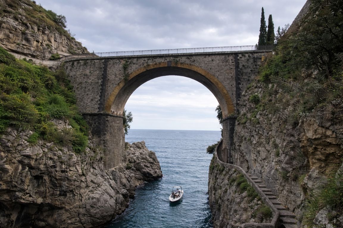
The ground changes character several times. Out of Bomerano you follow a paved lane, then a stony track that loses height gently. Past the fork at Colle La Serra the path narrows and traverses under cliffs, with the sea a very long way below and the surface loose in patches. In the middle third you cross old terraces on rock steps, some of them worn smooth and slippery when damp. The last kilometre into Nocelle is a sequence of stone staircases that punish tired knees far more than anything that came before.
| Stretch | What the ground is like | What it asks of you |
|---|---|---|
| Bomerano to Colle La Serra | Village lane, then a broad stony track losing height | Nothing unusual. This is the warm-up |
| Colle La Serra (578 m) onward | Narrow traverse under cliffs, loose in places, unfenced | Sure footing and a tolerance for exposure |
| The overhang and cave dwellings | Rock-cut path beneath a large overhanging face | Watch your head and your feet, not the view |
| Terrace section towards Nocelle | Old agricultural terraces, worn rock steps, some shade | Care when the stone is wet |
| The final approach to Nocelle | Long flights of stone steps, steep, sustained | Knees. This is where most people slow down |
| Nocelle down to Positano (optional) | A staircase of roughly 1,500 to 1,800 steps | A separate effort from the walk itself |
The honest summary is that this walk is easy on the lungs and hard on the nerves for anyone who dislikes heights. Fitness is rarely the limiting factor. Vertigo is. Several official and operator descriptions state plainly that the route is not suitable for people who suffer from vertigo, and the Comune di Agerola's own page flags exposed sections. Take that at face value rather than hoping it will be fine on the day.
Which Direction Should You Walk It, And Does It Matter?
Bomerano to Nocelle is the standard direction for good reason: it is net downhill by around 170 metres, it keeps Positano and the tip of the peninsula in front of you, and it puts the awkward bus connection at the start of the day when services are running. The reverse works, but you climb rather than descend and you spend the walk with the best view behind your shoulder.
| Bomerano to Nocelle | Nocelle to Bomerano | |
|---|---|---|
| Height change | 184 m up, 356 m down | 356 m up, 184 m down |
| The view | Ahead of you the whole way | Behind you unless you turn |
| Sun | Broadly with the light through the morning | Into the light later in the day |
| Transport at the start | One bus up from Amalfi, early | Local bus or steps up to Nocelle |
| Transport at the finish | Local bus or steps down to Positano | Bus down from Agerola, check the last one |
| Best for | Almost everyone | People already staying in Positano who want a climb |
One genuine argument for the reverse: if you are based in Positano and the morning bus connection to Agerola looks like it will eat two hours, walking up from Nocelle and taking a bus down from Bomerano at the end can be the simpler day. You pay for it with 356 metres of ascent, most of it on steps, in whatever heat the day has produced.
The featured guided hike ends in Nocelle, matching the direction described here. Decide on your onward bus or stair descent before booking. Plan the Nocelle finish
How Do You Get To The Bomerano Trailhead?
Bomerano is reached by SITA Sud bus from Amalfi, a ride of roughly 40 minutes on a service that runs through the day, and the trail begins at Piazza Paolo Capasso in the village. There is no direct bus from Positano or Sorrento, so from either you change in Amalfi, which is what turns a two-hour walk into a full day out.
| Starting from | How you get there | Rough travel time one way |
|---|---|---|
| Amalfi | Direct SITA Sud bus up to Agerola, alight at Bomerano | About 40 minutes |
| Praiano | Coast bus to Amalfi, change for Agerola | About 1 hour plus the connection |
| Positano | Coast bus to Amalfi, change for Agerola | About 1.5 hours plus the connection |
| Ravello or Atrani | Down to Amalfi, change for Agerola | About 1 hour plus the connection |
| Sorrento | Coast bus to Amalfi (90 to 100 minutes), change for Agerola | Half the morning, realistically |
| Naples side | Road up to Agerola from the Vesuvian side, or by private transfer | Varies; a transfer removes the changes |
Two rules that catch out first-timers on SITA Sud services. Tickets are not sold on board: buy them beforehand at a tobacconist, newsagent or bar showing the operator's sign, and buy the return at the same time, because Bomerano is a small village. And validate the ticket in the machine as you board, every time, because inspections do happen and the fine is not symbolic. If bus timetables and connections are the part of this coast you find most tiring, the wider question of getting around without a car is worth reading before you build the rest of your itinerary.
What does the guided Bomerano-to-Nocelle route involve? Follow an English-speaking guide along the Path of the Gods, with walking sticks supplied for the 4.5-hour outing. Discover The Guided Path Of The Gods Hike
What Happens At Colle La Serra, And Should You Take 327 Or 327a?
About two kilometres in, at the saddle of Colle La Serra at 578 metres, the path splits. Straight on, path 327 is the classic high traverse: more spectacular, more exposed. To the right, 327a is the lower variant, less panoramic and considerably kinder to anyone uneasy about drops. The two rejoin further along, so choosing the safer option costs you views rather than the walk itself.
This fork is the single most useful thing to know before you set out, because it is where a group discovers, too late, that one member is not enjoying themselves. Decide at the saddle rather than a hundred metres down the traverse. The signposting at the junction is clear and both branches carry the red-and-white waymarks.
Shortly after the fork the high path passes the Grotta del Biscotto, an enormous overhanging rock face named for its resemblance to the twice-baked bread of Agerola. Under the overhang are the remains of cave houses, with openings cut for doors and windows, thought to have sheltered hermits and later farmers. It is the one place on the walk where the history is as interesting as the view, and it is a natural stop for water and shade.
Choose your hiking date before arranging the journey to Bomerano and onward from Nocelle. Walk the Path of the Gods with an English-speaking guide and walking sticks on a 4.5-hour outing. Choose Your Path Of The Gods Date
How Do You Get Down From Nocelle, And How Many Steps Are There?
Three options: walk the staircase down to the coast road, take the small local bus down through Montepertuso to Positano, or stay in Nocelle for a drink and take the bus later. The staircase is the famous one, and published counts of it range from about 1,500 to about 1,800 steps. The Comune di Agerola's own page says 1,700. Nobody agrees, and after the first six hundred you stop caring.
| Way down | What it involves | Rough time | Cost |
|---|---|---|---|
| The staircase to Positano | Roughly 1,500 to 1,800 stone steps, then the coast road | 30 to 45 minutes, plus the walk into town | Free |
| Local Mobility bus from Nocelle | Small bus down via Montepertuso into Positano | About 20 minutes | EUR 1.30 bought in advance, EUR 1.80 on board |
| Stop in Nocelle first | Cafe terrace with the view, then bus or steps | As long as you like | Price of a drink |
If your knees are already complaining at Nocelle, take the bus. Descending 1,700 steps on tired legs at the end of a hot walk is how ankles get turned, and the staircase delivers you to the coast road above the town rather than to the beach, so there is more walking afterwards either way. The Comune di Agerola's page adds one more warning worth repeating: where the steps meet the road, watch for traffic. That road is narrow, busy and driven with commitment.
Once you reach Nocelle, decide between the local bus and the steps down to Positano. The guided hike compared below also finishes in Nocelle and excludes transfers, so the onward journey remains part of your own plan.
Leave room for lunch and the onward connection when planning the day; the hiking finish is not the end of your journey. Build the full hiking day
When Is The Best Time Of Year To Walk It?
April to early June and mid-September to early November are the windows almost every source agrees on. July and August are hot, crowded and largely without shade, and the deep winter months bring rain, short days and the possibility of the path being closed for weather or maintenance. Sources genuinely disagree about winter, which is covered below rather than glossed over.
| Period | Heat and shade | Crowds on the trail | Verdict |
|---|---|---|---|
| December to February | Cool, wet, short daylight | Very few people | Possible; check conditions locally first |
| March | Cool, changeable, greening up | Light | Good if the forecast is settled |
| April to early June | Comfortable, wildflowers, long light | Moderate and rising | The best window of the year |
| Late June | Getting hot on the exposed sections | Busy | Start at first light |
| July and August | Hot, very little shade, high sun | Busiest | Only very early, or skip it |
| Mid-September to October | Warm, softer light, sea still swimmable | Moderate | The other best window |
| November | Cooler, rain more likely | Light | Good on a clear day |
On winter, the sources part company. Some guides state the path is effectively open April to November and may close between December and March for weather, landslides or maintenance. Others point out that snow on this coast is rare and that the trail is walkable year round. Both are describing the same reality from different angles: it is not gated or ticketed, so nothing physically stops you, but wet rock, mud and a low sun on an unfenced traverse are a genuinely worse combination than the same path in May. Ask locally in Bomerano before setting out in winter. If you are still choosing dates for the whole trip, our best time to visit page covers the same seasonal trade-offs for the coast as a whole.
Whatever month you pick, weather on the ridge is not the weather on the beach. The traverse catches wind, cloud can sit on the tops while the coast is clear, and rain turns worn rock into a skating rink. Check the forecast the evening before and again at breakfast.
Choose the season and check current mountain conditions before booking; an open calendar is not a trail-condition report. Check the seasonal planning guide
What Should You Actually Carry?
Water is the single item people underestimate. Between 1.5 and 2 litres a person is the range the experienced sources converge on, because the exposed middle third has almost no shade and no reliable place to buy anything. Everything else on this list is cheap, light, and the difference between an excellent morning and a miserable one.
| Item | Why it matters here |
|---|---|
| 1.5 to 2 litres of water per person | Long unshaded traverses; refill points are not something to count on |
| Shoes with real grip | Worn rock and loose gravel. Sandals and smooth soles are the usual cause of falls |
| Sun hat and sunscreen | The exposure is to sun as well as to drops |
| A light layer | The ridge is windier and cooler than the coast, especially before nine |
| Cash in small notes and coins | Bus tickets from a village tobacconist, and the cafe in Nocelle |
| Offline map on your phone | Signal is patchy along the traverse; the fork at Colle La Serra is easier with a map |
| Snack or early lunch | There is nothing to buy between the two villages |
| Fully charged phone | Photographs plus map plus a possible bus timetable check will drain it |
What to leave behind: anything heavy, and any plan that involves carrying a beach bag. Swimming and hiking on the same day is possible, but do the walk first and go to the beaches afterwards with a lighter load.
What equipment comes with the guided walk? Discover the 4.5-hour Path of the Gods hike, with walking sticks and an English-speaking guide included. Discover The Guided Path Of The Gods Hike
What Does A Realistic Day On The Trail Look Like?
From Amalfi, budget the whole day rather than the two hours the trail sheet quotes. A morning start, the bus up, the walk, lunch in Nocelle or Positano, and the journey back typically fills seven to nine hours door to door. The timings below are a planning allowance built from published journey times, not a guaranteed schedule, and bus departures change with the season.
| Roughly | What you are doing |
|---|---|
| Before 08:00 | Buy bus tickets, including the return leg, and eat properly |
| Morning bus from Amalfi | About 40 minutes up to Agerola, alight at Bomerano |
| First 20 minutes | Find Piazza Paolo Capasso, follow the red-and-white 327 waymarks out of the village |
| Next 30 to 40 minutes | Steady descent to the fork at Colle La Serra; decide 327 or 327a here |
| The following hour | The traverse, the overhang and the cave dwellings, the long views to Capri |
| Final 45 minutes | Terraces, then the stone staircases down into Nocelle |
| At Nocelle | Cold drink on the terrace, then the local bus or the steps to Positano |
| Afternoon | Positano, a boat, or the bus back along the coast |
If you are trying to fit this into a short trip, be realistic about what else the day can hold. It is a morning, an afternoon of recovery, and not much else. Our page on how many days you actually need puts that in context against everything else people try to squeeze into three nights.
Put the guided hike on the calendar before planning the rest of your walking day. Spend 4.5 hours on the Bomerano-to-Nocelle route with an English-speaking guide and supplied walking sticks. Choose Your Path Of The Gods Date
Who Should Skip The Path Of The Gods?
Anyone with a real fear of heights, anyone unsteady on uneven ground, and anyone whose day depends on strict timing should choose something else. Several official and operator descriptions state that the route is unsuitable for young children, for people with vertigo and for anyone with mobility limitations, and those warnings are not boilerplate.
Pushchairs are out of the question. Small children who cannot be relied on to stay on the path in exposed sections are a genuine risk rather than a hard day. Recent knee or ankle trouble will meet its match on the staircases into Nocelle. And if rain has fallen in the last day or so, the worn rock steps are the specific hazard, not the drop.
The good news is that the same landscape is available at other angles. The villages of the Amalfi Coast are stacked up the same slopes and connected by shorter, gentler paths. The Valle delle Ferriere reserve behind Amalfi is a cool, shaded, damp valley of waterfalls, ruined medieval paper mills and giant Woodwardia radicans ferns, a survivor species from before the last glaciation, and it makes a far better hot-weather walk than an unshaded ridge. And a boat shows you the whole cliff line from below with no steps at all.
The featured operator excludes under-7s, pregnant participants, people with heart problems or low fitness, wheelchair users and people over 95. If those conditions apply, use a different plan; a guide does not waive them. Choose an alternative coast plan
Should You Walk It Alone Or With A Guide?
Most people walk it independently: the route is signed and popular in season. A guide adds interpretation of the cave dwellings and terraces and support with following the route. It does not remove the exposure or make the walk suitable for someone uncomfortable on uneven mountain paths.
The featured guided outing runs from Bomerano to Nocelle and lists a duration of 4.5 hours. Transfers are excluded: arrange travel to Bomerano and onward from Nocelle separately. Check the selected option’s full inclusions and meeting details before booking.
A guided Path of the Gods hike is now included in the comparison below, alongside alternatives for a different kind of coast day. The hiking operator excludes children under 7, pregnant participants, people with heart problems or low fitness, wheelchair users and people over 95; check the full participation requirements before booking.
What changes when you walk the Path of the Gods with a guide? Compare the guide’s interpretation and route support with the independent walk, then decide whether that is the value you want to add. Discover The Guided Path Of The Gods Hike
So Is It Worth It?
Yes, with conditions attached. Go in spring or autumn, start early, walk from Bomerano towards Nocelle, carry more water than feels necessary, and take the lower branch at Colle La Serra if heights bother you. Do that and you get two or three hours on a ridge with the Gulf of Salerno underneath you, Capri sitting off the end of the peninsula, and villages that look like spilled paint on the cliffs below. Ignore the heat, the shoes or the steps and you get a hard day out with a great view, which is not the same thing. If hiking is not the shape of your trip at all, the coast is just as good from a deck chair on a boat, and considerably kinder to your knees.
Choose your hiking date before coordinating the rest of your day. The guided Bomerano-to-Nocelle outing adds an English-speaking guide and walking sticks to your time on the trail. Choose Your Path Of The Gods Date
Frequently Asked Questions
How long does the Path of the Gods take to walk?
The official trail sheet from CAI Monti Lattari allows two hours in each direction for the 5.3 km signed route between Bomerano and Nocelle. In practice most visitors take closer to three hours because of photo stops, and the descent from Nocelle to Positano adds another 30 to 45 minutes if you take the steps rather than the local bus.
How difficult is the Path of the Gods?
It is graded E by the Italian Alpine Club, which means a walking route needing no equipment or technique but requiring sure footing and hill fitness. There is no scrambling. The real difficulty is exposure: several sections are narrow with a long unfenced drop, and official descriptions say the route is not suitable for people who suffer from vertigo.
Do you need to book or pay to hike the Path of the Gods?
No. The trail is a public mountain path with no ticket, no permit and no reservation. The only costs are the bus to Bomerano, the optional local bus down from Nocelle, and whatever you buy along the way.
Which direction is best, Bomerano to Nocelle or the reverse?
Bomerano to Nocelle is the standard direction. It is net downhill by around 170 metres, and it keeps Positano and Capri in view ahead of you the whole way. Walking the other way means climbing 356 metres, much of it on steps, with the best view behind you.
How many steps are there from Nocelle down to Positano?
Published counts range from about 1,500 to about 1,800; the Comune di Agerola's own page says 1,700. If you would rather not do them, the local Mobility bus runs down from Nocelle through Montepertuso into Positano for around EUR 1.30 bought in advance.
What is the best month to hike the Path of the Gods?
April to early June and mid-September to early November. Those windows give comfortable temperatures and long light. July and August combine high sun, very little shade and the heaviest crowds, so if you go then, start at first light.
What would you add to your independent day? Discover path of the gods hike and coast cruise, with departure points and the time each experience takes laid out below. Discover Path Of The Gods Hike & Alternatives